We are proud to announce the soft release of TopoDOT x64 Version 2021.1 for MicroStation CONNECT Update 15. TopoDOT for MicroStation V8i has not changed.
Important Notes Regarding Update Compatibility
TopoDOT 2021.1 is a soft release meaning it is still labeled “Beta” even though it is a stable release because it is meant to be installed for approved CONNECT products running on Update 15 or newer. Unfortunately, as of today Open Roads Designer (ORD) has not released an update which runs on the Update 15 Bentley engine. When a compatible version is released, we will be sending a follow up email notifying you of this change. Installing this TopoDOT update on an Update 14 Bentley product will limit some functionality; learn more about that here.
Watch the video below for highlights of the upcoming release of TopoDOT 2021.1 for Microstation CONNECT. including:
Click here for the Power Point file.
You may update TopoDOT from the select update branch tool and choose the beta version or the stable release after Feb 26 2021. You may also download it directly from the Software Downloads page.
New Features
Data Management
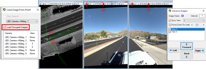
Easy data access is critically important to the effective administration of point cloud data. TopoDOT Data Management tools focus on data organization for easy access. New to this release is the Load Grouped Images function added to the Load Images from Point tools. It will allow images from multiple cameras of MLS projects to be loaded at the same time in multiple views. Pro tip: use the Advance imagery tool to move from position to position easily.
 |
Additionally, an “Include Subdirectories” option was added to the Conversion Wizard, Tile Parsing Wizard and Register Scan Folder to Icons tools. This option will speed up the folder selection process for the user.
Furthermore, there is now additional support for the Point Source ID field. The new Point Source ID display mode gives users another way to visualize the individual passes of a data collect in previously merged data. There is also now support for working with the point source id directly in the Deviation Overview tool and the Tile Parsing tool.
Data Extraction
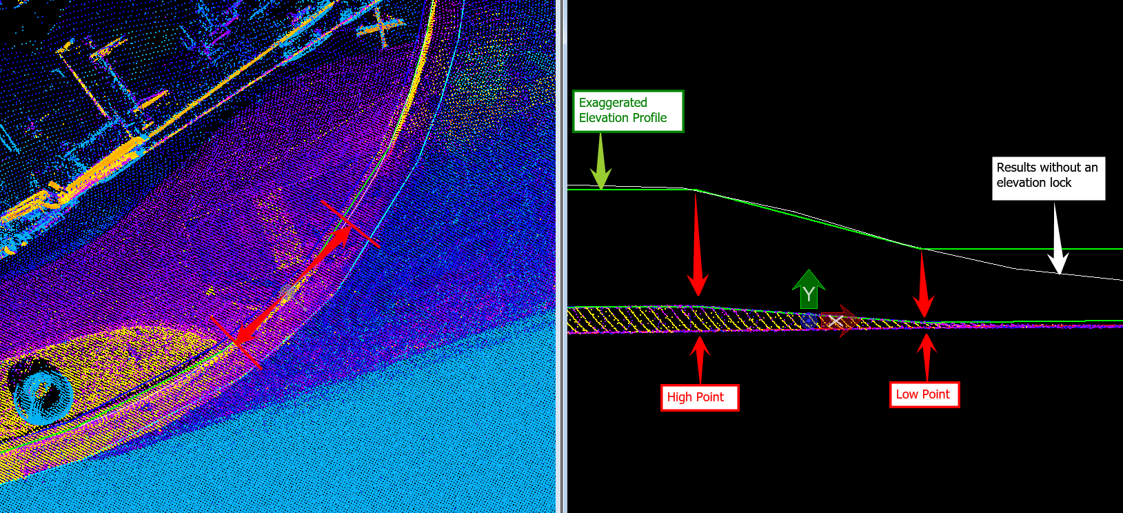
We are constantly improving upon the feature extraction workflow for our customers, and in this update we focused on improving one of the most used tools: the Drape Element to Data tool. It now has a new “Surface Analysis” extraction mode that improves ground detection over sloping surfaces. Additionally a new “Noise Removal” option is available to efficiently ignore low and high data that is sparse in nature.

Another area of development in this update was revising and implementing some changes to break-line extraction and editing. Here is a list of some of those new tools and improvements to existing tools:
- Added option to the Template by X-Section tool to detect and update existing line-work with additional vertices.
- New Smart Parallel tool that is similar to MicroStation’s Copy/Move in Parallel tool but it retains the elevation for a true horizontal offset.
- New Insert Connecting Vertices tool that adds handles where other elements are connected.
- The Deleting Points Near Selected Lines tool was updated to support deleting points around other points.
- New Fence Around Elements tool allows users to quickly create a boundary fence around selected linework.
- The Smart B-spline tool has added the ability to ‘lock’ the elevations.

Power Line Extraction
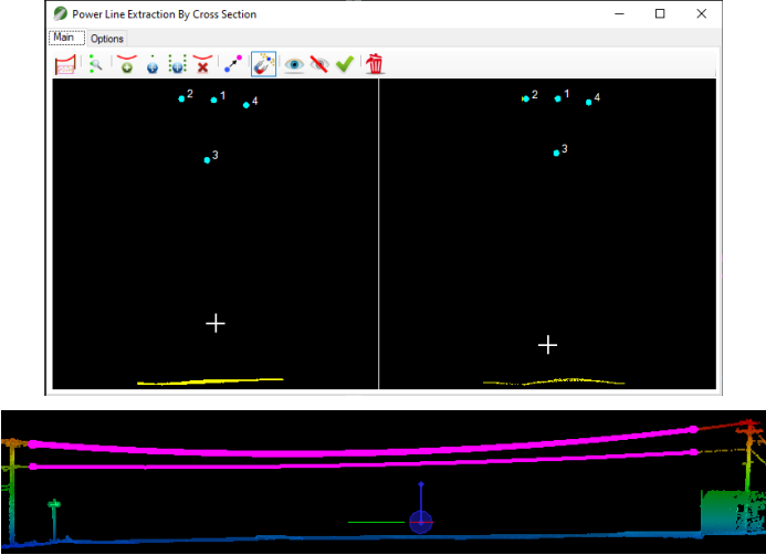
Power Line extraction routines for distribution and utilities projects have had a major overhaul. Here is a list of some of the changes.
- Automatic Wire Detection added to the Power Line Extraction By Cross Section tool.
- New Adjust Power Line tool to fine tuning wires vertically.
- New Extend Power Line tool to extend ends along wires.
- Enhanced the Join Power Line tool to automatically join all selected wires at attachment points.
These changes are briefly introduced in the Update Highlights Webinar, but they are explained more thoroughly in a recent Power Lines Webinar available here.

And much more…
Other changes worth mentioning are:
- New element attribution plotting capabilities.
- Random Noise filter was improved for localized height isolation.
- Additional Key-in commands added. See a full list here.
Please visit the change log for a full list of changes available in this update. You can find further information and tutorials in the TopoDOT Wiki-Manual by pressing F1 when the tool is open.
0 Comments