ASPRS (2022 Virtual Workshops)
Register and Join team TopoDOT: Contact with Jennifer Triana for more information
Register and Join team TopoDOT: Contact with Jennifer Triana for more information
Will you be attending the Land Surveyors’ Association of Washington LSAW Conference & Exposition? Don’t miss Presentation “Data Comparison and Applications of UAV – Drone Imagery Based Point-clouds vs UAS LiDAR Point-clouds” 👉 Date: Thursday, January 3rd, 2022 👉 Time: 3:30 – 5:00 pm EST 👉 Presented By:
Join #TopoDOT’s VP of Technology Integration, Tom Clemons, AASHTO Washington Briefing conference. March 1-4th at Washington, DC. 👉Connect with Tom to book a meeting
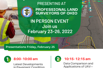
Join TopoDOT’s Senior Applications Engineer Mike Cook in person at @Professional Land Surveyors of Ohio (PLSO). Don’t miss your chance to catch up with him for one-on-one advice and software tips and attend his two insightful presentations. Contact:
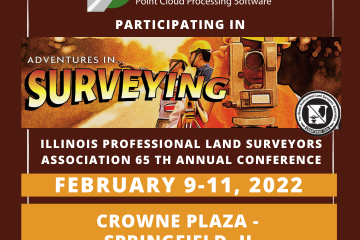
Calling all Illinois Surveyors: Come see us at IPLSA Conference! ➡️ Feb 9-11 2021. Join us! Contact TopoDOT Team
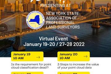
❇️ We are very excited that TopoDOT will be participating in the NYSAPLS Virtual Conference this week and next week; January 19 – 20, 27 – 28. Please join us at the TopoDOT virtual booth to discuss the latest tools and techniques for point cloud feature extraction to increase your Read more

PROFESSIONAL LAND SURVEYORS OF OHIO Join Mike and Felipe at PLSO This year where Mike will be presenting: “Data Comparison and Applications of UAV – Drone Imagery Based Point Clouds vs UAS LiDAR Based Point Clouds” ➡️ January 20th 2022 10:00-11:30 AM For more information contact:

Join us on Indiana Prof Land Surveyors (ISPLS), an in-person event. ➡️ Friday 14th 2022, from 8-11AM Mike present: An Introduction to TopoDOT – A Comprehensive Solution to Point Cloud Data Processing – with the topic of UAV drone data. Click here to connect with Mike or David on LinkedIn:
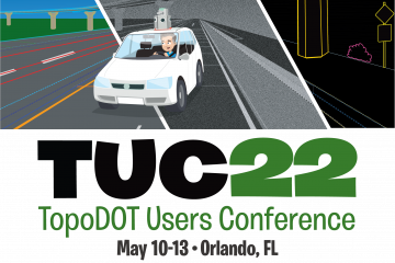
Welcome to The TopoDOT User Conference TUC 2022! Slots tend to fill up quickly so we suggest you sign up to yoursession early. This year you can attend both virtually and in person University of Central FL. Rosen College 9907 Universal Blvd Orlando, FL 32819 Learn more and register here: Read more