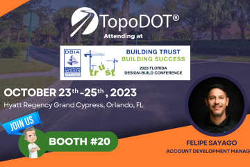
• TopoDOT
  • Need Support?
TopoDOT Logo - Point Cloud Processing Software
  • Home
  • News
  • Technology
  • Training & Support
  • Technotes
  • Events
  • Webinars

Point Cloud Data

Land Surveyors’ Association of Washington (LSAW)

Will you be attending the Land Surveyors’ Association of Washington LSAW Conference & Exposition? Don’t miss Presentation “Data Comparison and Applications of UAV – Drone Imagery Based Point-clouds vs UAS LiDAR Point-clouds” 👉 Date: Thursday, January 3rd, 2022 👉 Time: 3:30 – 5:00 pm EST 👉 Presented By:

By Marcela Moreno, 4 monthsMarch 2, 2022 ago

2022 AASHTO Washington Briefing

Join #TopoDOT’s VP of Technology Integration, Tom Clemons, AASHTO Washington Briefing conference. March 1-4th at Washington, DC. 👉Connect with Tom to book a meeting

By Marcela Moreno, 4 monthsMarch 1, 2022 ago

Professional Land Surveyors of Ohio (PLSO)

Join TopoDOT’s Senior Applications Engineer Mike Cook in person at @Professional Land Surveyors of Ohio (PLSO). Don’t miss your chance to catch up with him for one-on-one advice and software tips and attend his two insightful presentations. Contact:

By Marcela Moreno, 4 monthsFebruary 23, 2022 ago

🎳 BOWLING GEO WEEK

Attending GEOWEEK? Join us at our 🎳 Bowling 🎳 Social! ➡️ When:  Monday, Feb 7th from 7:00pm to 10:00pm. ➡️ Where: Lucky Strike Denver Denver Pavilions 500 16th Street Mall, Suite 340 Denver, CO 80202

By Marcela Moreno, 5 monthsFebruary 7, 2022 ago

GEO WEEK

We’re so excited to be Participating at the 2022 @GEOWEEK ➡️ Dates: 21-23 September Have a chat, book a demo, meet the team.

By Marcela Moreno, 5 monthsFebruary 6, 2022 ago

NEW YORK STATE ASSOCIATION OF PROFESSIONAL LAND SURVEYORS (NYSAPLS)

❇️ We are very excited that TopoDOT will be participating in the NYSAPLS Virtual Conference this week and next week; January 19 – 20, 27 – 28. Please join us at the TopoDOT virtual booth to discuss the latest tools and techniques for point cloud feature extraction to increase your Read more…

By Marcela Moreno, 5 monthsJanuary 19, 2022 ago

PROFESSIONAL LAND SURVEYORS OF OHIO (PLSO)

PROFESSIONAL LAND SURVEYORS OF OHIO Join Mike and Felipe at PLSO This year where Mike will be presenting: “Data Comparison and Applications of UAV – Drone Imagery Based Point Clouds vs UAS LiDAR Based Point Clouds” ➡️ January 20th 2022 10:00-11:30 AM For more information contact:

By Marcela Moreno, 5 monthsJanuary 19, 2022 ago

Indiana Prof Land Surveyors (ISPLS)

Join us on Indiana Prof Land Surveyors (ISPLS), an in-person event. ➡️ Friday 14th 2022, from 8-11AM Mike present: An Introduction to TopoDOT – A Comprehensive Solution to Point Cloud Data Processing – with the topic of UAV drone data. Click here to connect with Mike or David on LinkedIn:

By Marcela Moreno, 6 monthsJanuary 12, 2022 ago

AASHTO Annual Meeting

The AASHTO speaks event is one of the transportation industry’s most important conferences of the year, bringing together experts from the public and private sector to share the latest in industry policy and innovation.

By Marcela Moreno, 8 monthsOctober 26, 2021 ago

Mid-Atlantic Geospatial Transportation Users Group (MAGTUG)

TopoDOT is honor to be invited by the Mid-Atlantic Geospatial Transportation Users Group (MAGTUG) to present:
Latest Developments in Pavement Condition Analysis using LiDAR by TopoDOT

By Marcela Moreno, 8 monthsOctober 20, 2021 ago

Posts navigation

Previous 1 2 3 Next
Recent Posts
  • #1039: TopoDOT® Version 2022.0 Release Highlights
  • #1038: Data Comparison and Applications of UAS Imagery and LiDAR Systems
  • #1037: Road Surface Analysis Toolset for Extracting, Identifying and Labeling Road Distress Information
  • TopoDOT Software Update Version 2021.1
  • How to Choose the Best Point Cloud Processing Software
  • Home
  • News
  • Technology
  • Training & Support
  • Technotes
  • Events
  • Webinars