Riscan Pro users accustomed to importing the point cloud data and imagery data into TopoDOT using the Project.RSP file will now need to export the project as an E57 format when using the GeoSys Manager instead.
The RSP file won’t retain the projection information. This is especially true for projects registered with the targetless Registration 2.0 method.
The E57 format can be used in TopoDOT just like a RSP file would. Please refer to Technote #1022 for more information on how to use the E57 format in TopoDOT.
This document outlines the correct way to export E57 format from Riscan Pro to the date of this Technote. E57 is a metric format so it needs to be exported in meters even if the project was created using feet or survey feet.
- Pull down the Help menu on the top and select Wizard ‘Export’.
- Select ASTM E57 in the Export Format and browse for a location to store the file.

- If your Axis units are in any units other that meters, then select the coordinate system the data needs to be projected to and click on the wrench icon next to it.
- Choose the select option under Coordinate Reference System
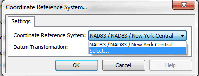
- Click on the edit icon next to the Record that was selected
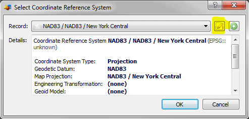
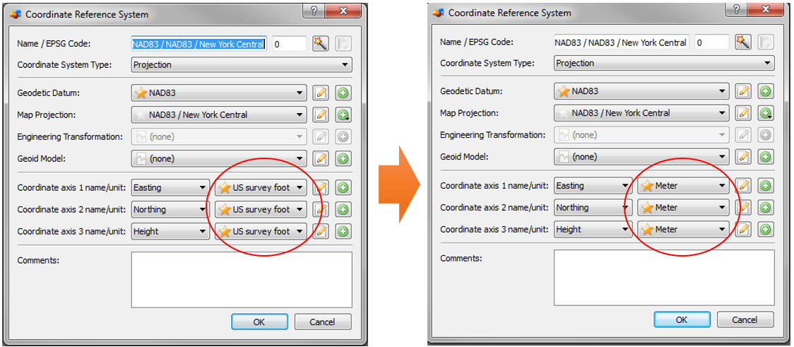
- Change the Coordinate Axis units to meters. This is a temporary change in order to export. You can change it back after it is exported. After changing click OK in all the previous windows.
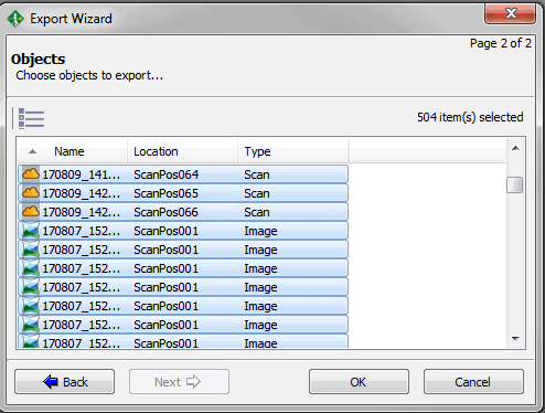
- Click Next on the Export Wizard, and select all files including scans and images
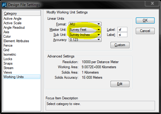
- TopoDOT will scale the data to the Design File Settings in your DGN. No need to set the TopoDOT units to meters, it will scale the data to whatever the drawing settings are because it knows that E57 is always in meters.
- Use Technote #1022 to map and load scan positions and images from the exported E57 file.
1 Comment
Ananda · August 28, 2018 at 10:13 PM
Nicely done.